 UKGEOS Data Catalogue
.shp
Type of resources
Topics
Keywords
Contact for the resource
Provided by
Years
Formats
Representation types
Update frequencies
-
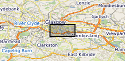
The UK Geoenergy Observatories (UKGEOS) Glasgow 3D coal mine model outputs, created by the British Geological Survey, provide a semi-regional overview of the depth and extent of surveyed and probable coal mine workings, plus stone and coal roads surveyed within the mines. The model allows users to visualise the surveyed and probable coal mine workings to be found beneath this part of Glasgow, applicable at a scale of around 1: 25,000 to 1: 10,000. The data is supplied as grids, triangulated surfaces over a 5 by 4.15 km area, with the depth range to around 300 m below Ordnance Datum. The mine extents are ‘cut out’ of the UKGEOS Glasgow post-drill bedrock model. This model describes both surveyed (recorded on mine abandonment plan) and probable coal mine workings. An area of probable workings has been updated to account for the results of drilling borehole GGC01. Further details and model limitations can be found in the accompanying metadata report http://nora.nerc.ac.uk/id/eprint/531157/
-
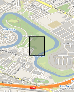
This summary borehole information release is for ‘as-built’ mine water and environmental baseline monitoring boreholes of the UK Geoenergy Observatories (UKGEOS) Glasgow facility at Cuningar Loop. The information pack from BGS contains a brief report with summary tables of locations, drilled depths, screened intervals and illustrative interpretations, and is accompanied with a spreadsheet and shapefile of the borehole locations and drilled depths. The purpose is to give potential users of the Glasgow Observatory an outline of the as-built infrastructure including condition of the target mine workings, as a summary of the more detailed information packs for each borehole. This dataset was updated in June 2020. Further details can be found in the accompanying report http://nora.nerc.ac.uk/id/eprint/526889
-

The borehole information pack from borehole GGC01, site 10 of the UK Geoenergy Observatories (UKGEOS) Glasgow facility. This final data release pack from BGS contains geophysical (MSCL-S), Near Infrared (NIR) and X-ray Fluorescence (XRF; mineralogical and chemical) core scan and core-wireline depth integration data, in addition to sedimentology, discontinuity and engineering logs, core scan optical and X-ray images, composite and digital wireline logs, drillers' summary logs and prognosis, sample recovery information spreadsheets and daily drillers' borehole records that were contained within the now-superseded intermediate data release. The cored, seismic monitoring borehole was drilled between 19 November and 12 December 2018 to 199m producing a core of 102 mm diameter. The borehole was wireline logged in December 2018 and a string of 5 seismometers were installed in February 2019. A range of fluid, water and core samples were taken during the drilling process. The borehole information pack- final release contains a range of logs on the core as well as images and scans of that core, these data were acquired in the first half of 2019 and late 2020/early 2021. The final data release for GGC01 includes: 1. UKGEOSGlasgow_GGC01_Final.zip file that includes the majority of the various data files, including files from the intermediate and initial data packs. 2. UKGEOSGlasgowGGC01_slabbedhighresimages.zip that contains the slabbed core optical images, 51GB in size. 3. Intermediate Borehole Information Pack - Part Two, high resolution whole core optical and radiographic images https://doi.org/10.5285/0b49f25b-a5d6-401c-98ff-397ad9ee9ed1 71GB in size, already released. Further details and model limitations can be found in the accompanying report http://nora.nerc.ac.uk/id/eprint/530762