 UKGEOS Data Catalogue
Type of resources
Topics
Keywords
Contact for the resource
Provided by
Years
Formats
Representation types
Update frequencies
-

UKGEOS and Core Sample Analysis. Geomechanical testing was performed to determine triaxial compressional strength, tensile strength, frictional strength and permeability of sandstones, siltstones, mudstones and coals from eleven depth intervals within the GGC01 borehole, UK Geoenergy Observatories (UKGEOS), Glasgow, United Kingdom. Frictional strength tests were also performed on cuttings samples of sandstones, siltstones, mudstones and coals from the GGA08 borehole, Glasgow, United Kingdom. In total twenty-three tensile strength tests were performed on ten sampled intervals, and seven porosity measurements pre-and post-failure were taken. Nine triaxial compressive strength tests and twenty-one frictional strength tests were performed, with permeability measured both before and after failure or shear respectively. From compressive strength tests we also determined the Young’s modulus and Poisson’s ratio. Results of X-Ray Diffraction are also included in the dataset.
-

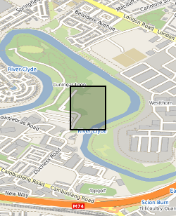
Data produced during three BGS ground gas surveys (August 2018, and May and October 2019) of up to 83 point measurements across four pre-determined locations within the UK Geoenergy Observatories (UKGEOS) Glasgow site, located to the south of the Cuningar Loop Woodland Park. The dataset includes measurements of CH4 and CO2 flux between the ground surface and lower atmosphere, along with concentrations of CO2, O2, H2, H2S and ‘residual balance’ in near surface ground gas measured at c.70 cm below ground level. Further details about the dataset can be found in the accompanying report. http://nora.nerc.ac.uk/id/eprint/528737/
-

The UK Geoenergy Observatories (UKGEOS) Glasgow facility, baseline soil geochemistry dataset released from the BGS comprises an excel file with two spreadsheets. The first spreadsheet contains information on the chemical composition of 90 topsoil (0 - 20 cm) samples collected from seven initially proposed borehole sites for the UKGEOS Glasgow facility, and from two control sites, in February-March 2018 (03-18). Ten samples were collected from each site prior to installation of the UKGEOS Glasgow facility, and underwent laboratory analysis. Chemical data for pH and the total concentrations of 54 inorganic and 75 organic substances in the soil samples are presented. In addition, the dataset contains locational and descriptive information about the samples noted during sampling. The analyte name, element chemical symbols, analytical method, units of measurement and limits of quantification are recorded in header rows at the top of the spreadsheet. The dataset includes qualifiers, highlighting any quality control issues reported with the data. The data qualifiers are explained in the second spreadsheet released with the data. Further details about the dataset can be found in the accompanying report http://nora.nerc.ac.uk/id/eprint/527798/.
-
This summary borehole information release is for ‘as-built’ mine water and environmental baseline monitoring boreholes of the UK Geoenergy Observatories (UKGEOS) Glasgow facility at Cuningar Loop. The information pack from BGS contains a brief report with summary tables of locations, drilled depths, screened intervals and illustrative interpretations, and is accompanied with a spreadsheet and shapefile of the borehole locations and drilled depths. The purpose is to give potential users of the Glasgow Observatory an outline of the as-built infrastructure including condition of the target mine workings, as a summary of the more detailed information packs for each borehole. This dataset was updated in June 2020. Further details can be found in the accompanying report http://nora.nerc.ac.uk/id/eprint/526889
-

The borehole information pack from borehole GGC01, site 10 of the UK Geoenergy Observatories (UKGEOS) Glasgow facility. This final data release pack from BGS contains geophysical (MSCL-S), Near Infrared (NIR) and X-ray Fluorescence (XRF; mineralogical and chemical) core scan and core-wireline depth integration data, in addition to sedimentology, discontinuity and engineering logs, core scan optical and X-ray images, composite and digital wireline logs, drillers' summary logs and prognosis, sample recovery information spreadsheets and daily drillers' borehole records that were contained within the now-superseded intermediate data release. The cored, seismic monitoring borehole was drilled between 19 November and 12 December 2018 to 199m producing a core of 102 mm diameter. The borehole was wireline logged in December 2018 and a string of 5 seismometers were installed in February 2019. A range of fluid, water and core samples were taken during the drilling process. The borehole information pack- final release contains a range of logs on the core as well as images and scans of that core, these data were acquired in the first half of 2019 and late 2020/early 2021. The final data release for GGC01 includes: 1. UKGEOSGlasgow_GGC01_Final.zip file that includes the majority of the various data files, including files from the intermediate and initial data packs. 2. UKGEOSGlasgowGGC01_slabbedhighresimages.zip that contains the slabbed core optical images, 51GB in size. 3. Intermediate Borehole Information Pack - Part Two, high resolution whole core optical and radiographic images https://doi.org/10.5285/0b49f25b-a5d6-401c-98ff-397ad9ee9ed1 71GB in size, already released. Further details and model limitations can be found in the accompanying report http://nora.nerc.ac.uk/id/eprint/530762
-

This data pack contains information from geotechnical and contaminated land investigations carried out at potential sites for the development of the UK Geoenergy Observatory in Cheshire. Following these investigations, a decision was made to move the proposed observatory to Thornton Science Park. None of the sites discussed in this data pack are in scope for development as part of the Cheshire Observatory. In total 16 holes were drilled using a variety of techniques. The only hole to be drilled using rotary coring was BHA-101. This borehole was cored extensively and logged with wireline geophysical tools. As such this is the main focus of the data pack. BHA-101 was drilled to TD of 121.2 m between 19-Nov-2020 and 09-Dec-2020. Drill core was collected from 51 m – 121 mm with 100 mm diameter. This initial data release pack from BGS contains composite and digital wireline logs alongside daily driller's borehole records.
-

The initial borehole information pack from the TH0424 Ground Investigation Borehole drilled as part of the UK Geoenergy Observatories (UKGEOS) Cheshire facility. TH0424 was drilled to TD of 101 m between the 08-Nov-2021 and 30-Nov-2021. Drill core was collected from 2 m – 101 mm with 100 mm diameter. This initial data release pack from BGS contains composite and digital wireline logs alongside daily driller's borehole records. This information pack also contains the Initial Core Scan dataset from the BGS Core Scanning Facility (https://doi.org/10.5285/b06d44e6-324d-4e19-bf78-a4520b9b87c8).
-

The borehole information pack from borehole GGC01, site 10 of the UK Geoenergy Observatories (UKGEOS) Glasgow facility. This initial data release pack from BGS contains composite and digital wireline logs; drillers summary logs and prognosis; sample recovery information spreadsheets; and daily driller's borehole records. The cored, seismic monitoring borehole was drilled between 19 November and 12 December 2018 to 199m producing a core of 102 mm diameter. The borehole was wireline logged in December 2018 and a string of 5 seismometers were installed in February 2019. A range of fluid, water and core samples were taken during the drilling process.
-

The borehole information pack from borehole GGC01, site 10 of the UK Geoenergy Observatories (UKGEOS) Glasgow facility. This intermediate data release pack from BGS contains sedimentology, discontinuity and engineering logs, as well as the information contained within the initial release: composite and digital wireline logs; drillers summary logs and prognosis; sample recovery information spreadsheets; and daily driller's borehole records. The cored, seismic monitoring borehole was drilled between 19 November and 12 December 2018 to 199m producing a core of 102 mm diameter. The borehole was wireline logged in December 2018 and a string of 5 seismometers were installed in February 2019. A range of fluid, water and core samples were taken during the drilling process. The borehole information pack- intermediate release contains a range of logs on the core as well as images of that core, these data were acquired in the first half of 2019. More information is available in the accompanying metadata report http://nora.nerc.ac.uk/id/eprint/525009.